Copyright © 2013 NRG Engineering Services Ltd. All right reserved
Member of the Chartered Institute of Civil Engineering Surveyors Ordnance Survey Britain's national mapping agency NRG Surveys Internationally recognised leader in the field of Civil Engineering and Land Survey software solutions Our Services Projects Clients Equipment Contact Us Links Utility Mapping Our Services Home
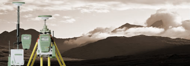
At NRG we provide a full Underground Utility Mapping service using the latest non invasive detection techniques. 
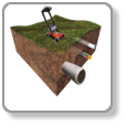
Our services are employed by various sectors, for a variety of different purposes: • Providing detailed utility plans alongside a full topographical survey at the design stage of a new project. • Avoidance of utility strike when excavating. • Updating existing utility records. 
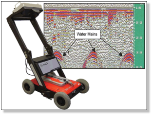
The image above shows a Ground Penetrating radar (GPR), with results showing the position and depth of three water mains. A utility survey will be carried out in a number of stages depending on the accuracy required by the client.
Utility Mapping
Desktop Study  A study of existing records is usually essential and used in planning of the survey campaign. Services detailed in these existing records can be plotted onto the clients existing topographic survey. Topographic Survey  A detailed survey of topographic features will enable the utilities to be referenced on the Ground. NRG can carry out the topographic survey as part of a package, but are happy to work with one supplied by the client. Alternatively, Ordnance survey mapping may be used but the client should be aware of it’s accuracies. Field Inspection  An inspection of each utility infrastructure, inspection covers, manholes, valves etc, with the attributes being recorded, measured and photographed. Radio detection  Detection using radio methods to locate conducting lines such as telecom and power cables. Radio sonde detection  Introducing a radio transmitter to open pipework and detecting the position of the sonde above ground enables the precise location of sewers and the like. Ground penetrating radar  GPR is employed to pick up variations in the substrata and is used to detect voids such as pipes. This is done over a grid system and the results analysed for further investigation and plotting.
NRG Engineering Services Ltd Land and Engineering Surveyors